
The Behind the Scenes of Protecting Land
By Angie Langevin
Have you ever wondered what happens after TRGT purchases a property? It may seem like a matter of sitting back and letting the forest simply “be,” but there is a lot more that goes on behind the scenes in the world of land conservation. Many people devote their entire careers to it!
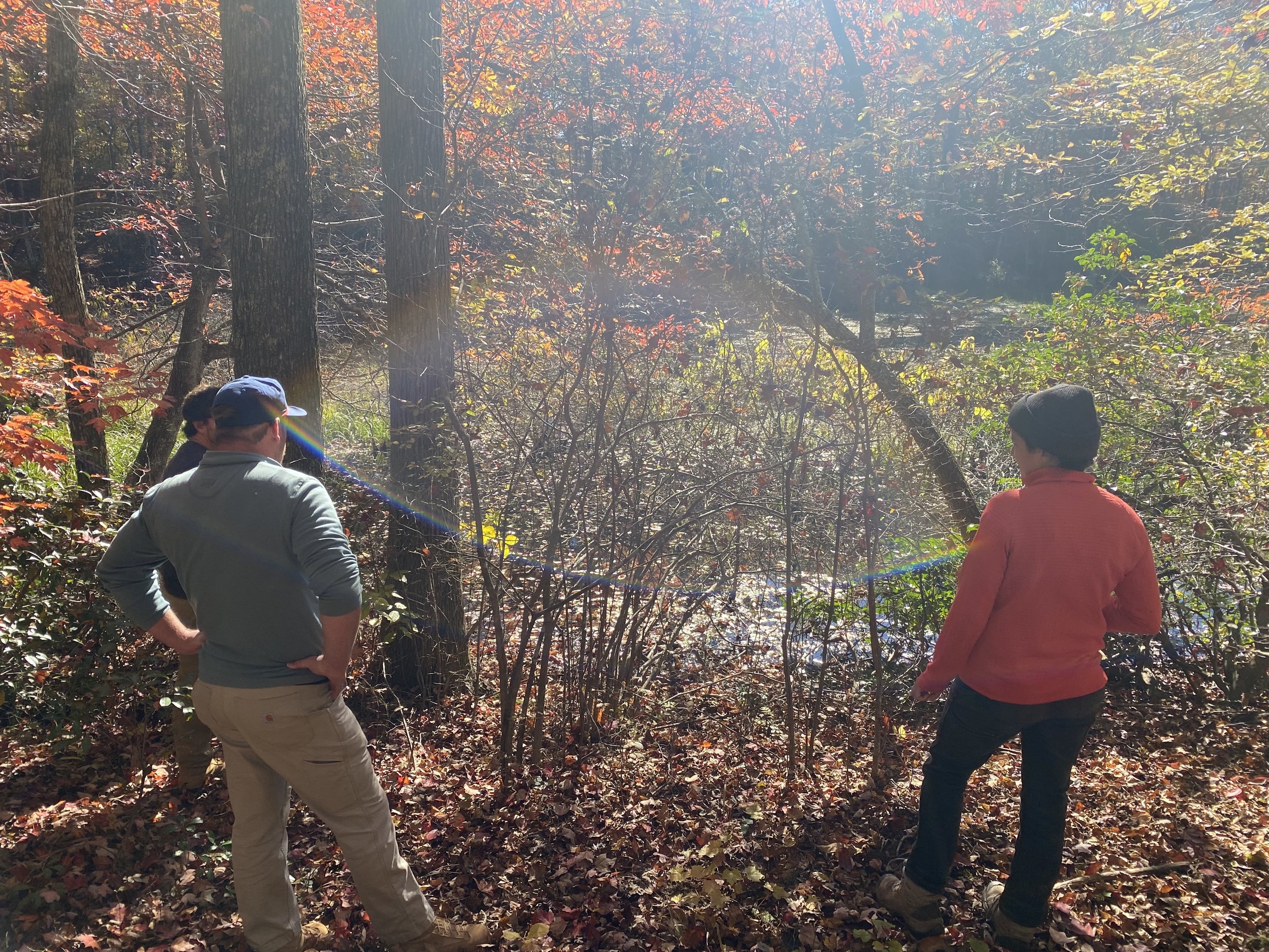
To protect land, we need to first know what exactly we own. This process begins before the closing date is even set. We take time to research the property; we read deeds, peruse surveys, and talk to the landowner. The first step TRGT takes after we buy land is to visit the property and mark all the boundaries. Imagine hiking and mapping the perimeter of a property like a surveyor would do. We mark our perimeter to let everyone know that the land inside is a protected area, just like a National Park or National Forest Service does. You can read more about this process in our blog post about it here.
After we map the properties’ boundaries, we can use GIS technology to create and share maps of our lands with the community. If you haven’t seen our interactive land map yet, check it out here.
The next step in conservation is to study the ecosystem of the new properties. Over multiple site visits, we map rare species, special habitats, unique geological features, and hydrology. We also study the cultural history of the land. It is important that we at TRGT understand how we fit in to the fabric of the land stewards that came before us. Much of the land we now protect was once stewarded by the Cherokee people and by other Indigenous people before them. Our goal is to understand the land as a whole so we can make the best plan for protecting it going forward.
Some properties may have amazing scenic views or recreational opportunities such as great potential campsites, hiking trails, rock climbing areas, or caves. Edwards Point is a great example - it already hosts a stellar view and a popular hike along the Cumberland Trail. In many cases like Edwards Point, we work to keep compatible recreation access open to our community. We also work with conservation partners like the Cumberland Trail, Southeastern Climbers Coalition, and Southeastern Cave Conservancy to preserve access to special recreational sites. Our goal is to balance low impact recreation with habitat conservation in these cases. We use information we learn from studying these properties to make these important decisions about how the lands will be used in the future.

As you can see, land conservation doesn’t end once the property has been bought. It takes time, expert staff, and passion from our entire community. This iterative process of walking the land, studying the ecosystem, and enacting a plan also includes one final key element - you! Any time you take a hike on one or our trails, tell a friend about the story of the gorge. When you enjoy an amazing view at Edwards Point, you become a steward of the land. We can't do it alone- it takes a community of individuals caring about land in order to protect it. After all, our community is helping us raise the dollars to pay for these lands. However, it doesn't end there - your word and passion go farther than you'd think. Please share our story with your friends, take a hike on one of our trails, and spend some time becoming part of our community of conservation! If you’d like to donate to our capital land campaign, click the link below! If you'd prefer to help in other ways, please share our story with your friends.