

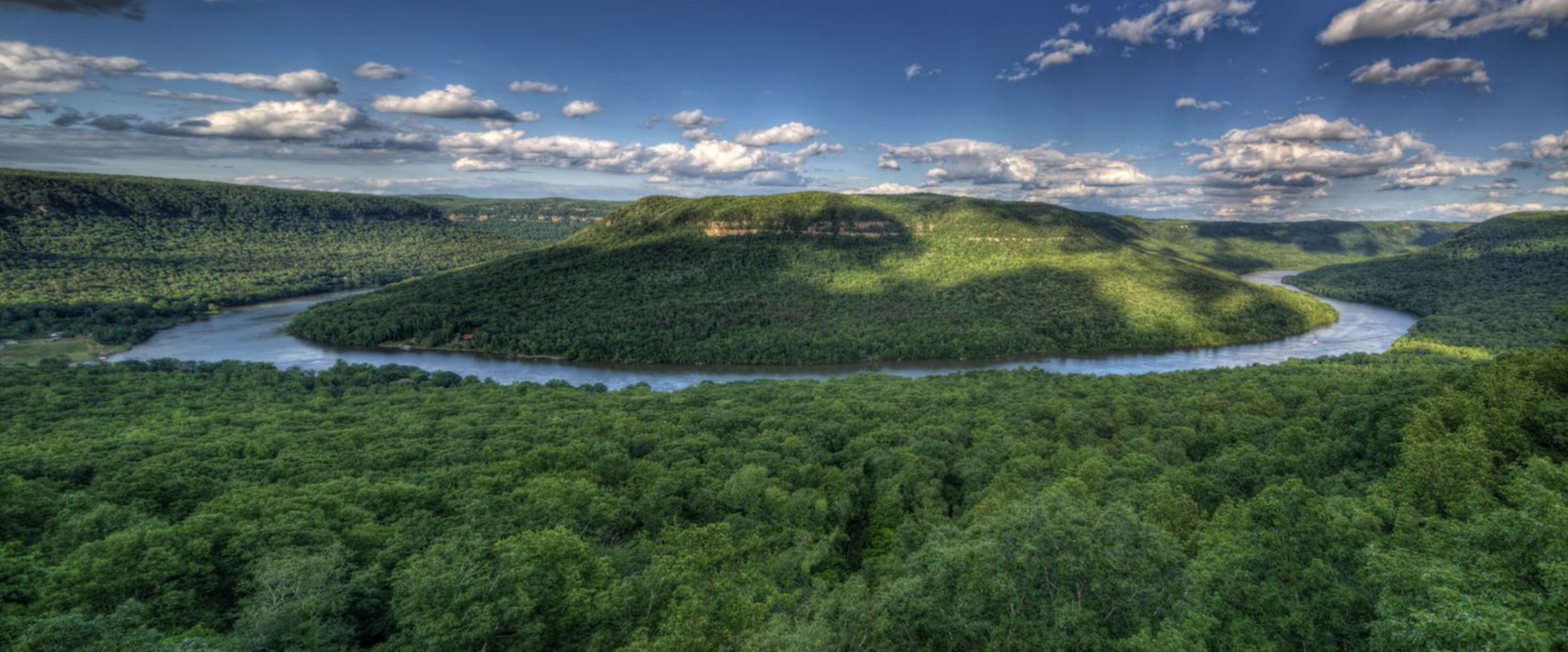
Explore the Tennessee River Gorge by the Cumberland Trail
By Eliot Berz
If you are looking for an outdoor excursion, the Cumberland Trail through the Tennessee River Gorge offers exceptional hiking with unrivaled views along the way. This trail takes hikers to some of our area’s most celebrated natural treasures such as Snoopers Rock, Edwards Point, mushroom rock, and Suck Creek. From waterfalls and scenic overlooks to unbroken forests and picturesque creeks, this section of the Cumberland Trail truly has it all.
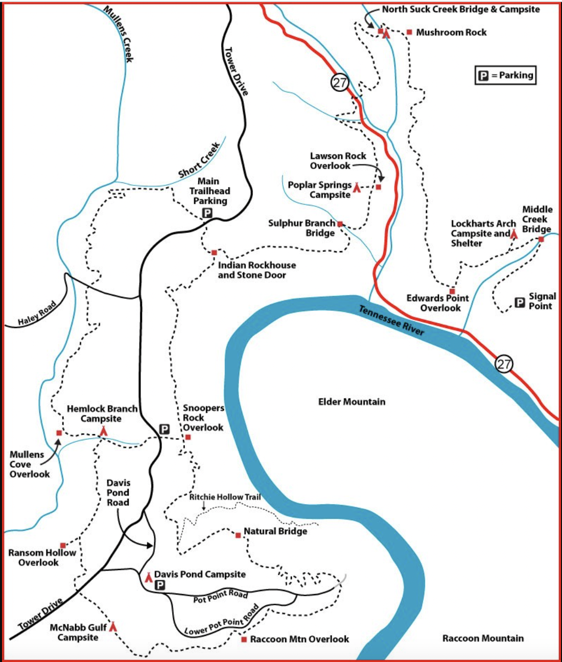
The Tennessee River Gorge Sections
Signal Point to Suck Creek

This 8.2-mile one way section begins at Signal Point Park and ends on Suck Creek Road (HWY 27). Although strenuous, there are exceptionally scenic and rewarding overlooks along the way. The trail also works its way down the mountain into North and South Suck Creek. Highlights include Signal Point, Julia Falls, Lockhart’s Arch and Campground, Middle Creek, Edwards Point, Mushroom Rock, and the North Suck Creek suspension bridge. For more information and directions, visit this Cumberland Trails Conference page. Edwards Point is also accessible by a shorter 3.8-mile out and back trail beginning at the Rainbow Falls Parking Area.
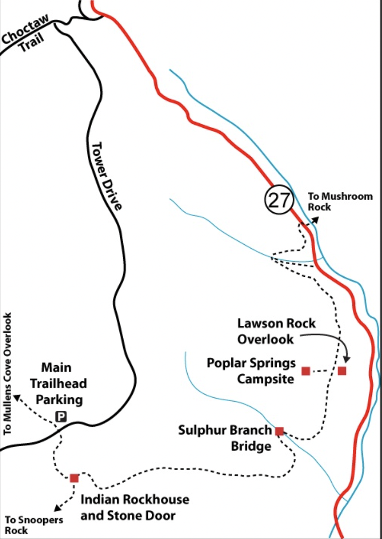
Poplar Springs

The Poplar Springs section is a 4.9-mile one way trail that takes hikers from Suck Creek Road up to the top of the Prentice Cooper Wildlife Management Area to PC’s primary Cumberland Trailhead parking lot. The trail meanders through incredible patches of rhododendron and mountain laurel and unique rock features. Keep in mind that this area is closed during Prentice Cooper’s fall and spring hunt dates. Highlights include Lawson Rock Overlook, Poplar Springs Campsite, Sulphur Branch, and Indian Rockhouse and Stone Door.
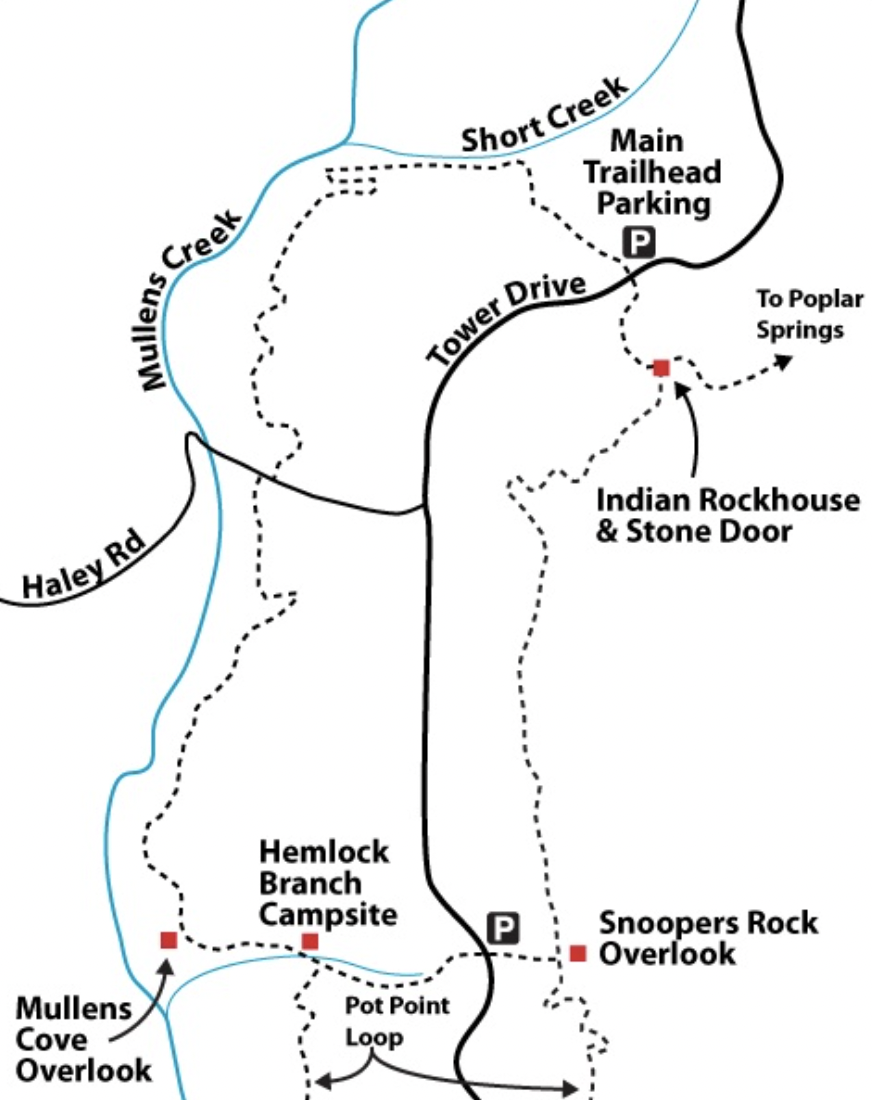
Mullens Cove Loop
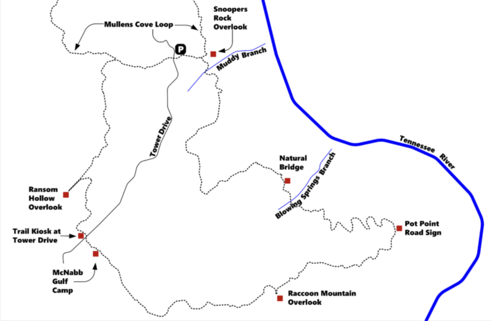
The Mullens Cove Loop is a 9.8 mile loop that can be started at Prentice Cooper’s Cumberland Trail parking area on Tower Road or from the Snoopers Rock parking area. This loop takes hikers past the popular Indian Rockhouse and Stone Door and one of Chattanooga’s most celebrated overlooks: Snoopers Rock. Snoopers Rock is a must see for local or visiting outdoor enthusiasts. This area is closed during Prentice Cooper’s fall and spring hunt dates. Other highlights include the Mullens Cove Overlook, Mullens Creek, Short Creek, and the Hemlock Branch Campsite. If you’re here in the spring or summer, be sure to keep your eyes out for the Louisiana Waterthrush in Mullens and Short Creeks!
Pot Point Loop

The Pot Point Loop is a 11.7 mile loop that begins at Snoopers Rock. This section contains a variety of overlooks: Snoopers Rock, Raccoon Mountain Overlook, and Ransom Hollow Overlook. The trail also takes hikers by Natural Bridge and Blowing Springs Branch. If you’re up for a high mileage day, you can hike down the Ritchie Hollow Trail where it intersects the Cumberland Trail for an out and back detour to Blowing Wind Falls. This area is also closed during Prentice Cooper’s fall and spring hunt dates.
Map Provided by the Cumberland Trail Conference
The Cumberland Trail spans from the Cumberland Gap in Kentucky to Signal Mountain, Tennessee. The Tennessee River Gorge marks the southern end of this extensive trail system. For more information about the Cumberland Trail segment through the Tennessee River Gorge, you can visit the Cumberland Trail Conferences website.