
Edwards Point
Access

Photo by Kevin Livingood
Edwards Point can be reached by the Cumberland Trail. The nearest trailhead at 1.9 miles away is the Rainbow Lake Parking Lot on Ohio Avenue in Signal Mountain, TN. A map of the trail can be found below.
This section of trail is made possible by a collaborative effort. On Signal Mountain, the Cumberland Trail travels through properties owned by the Tennessee River Gorge Trust, Town of Signal, and Prentice Cooper State Forest.
Protecting Edwards Point
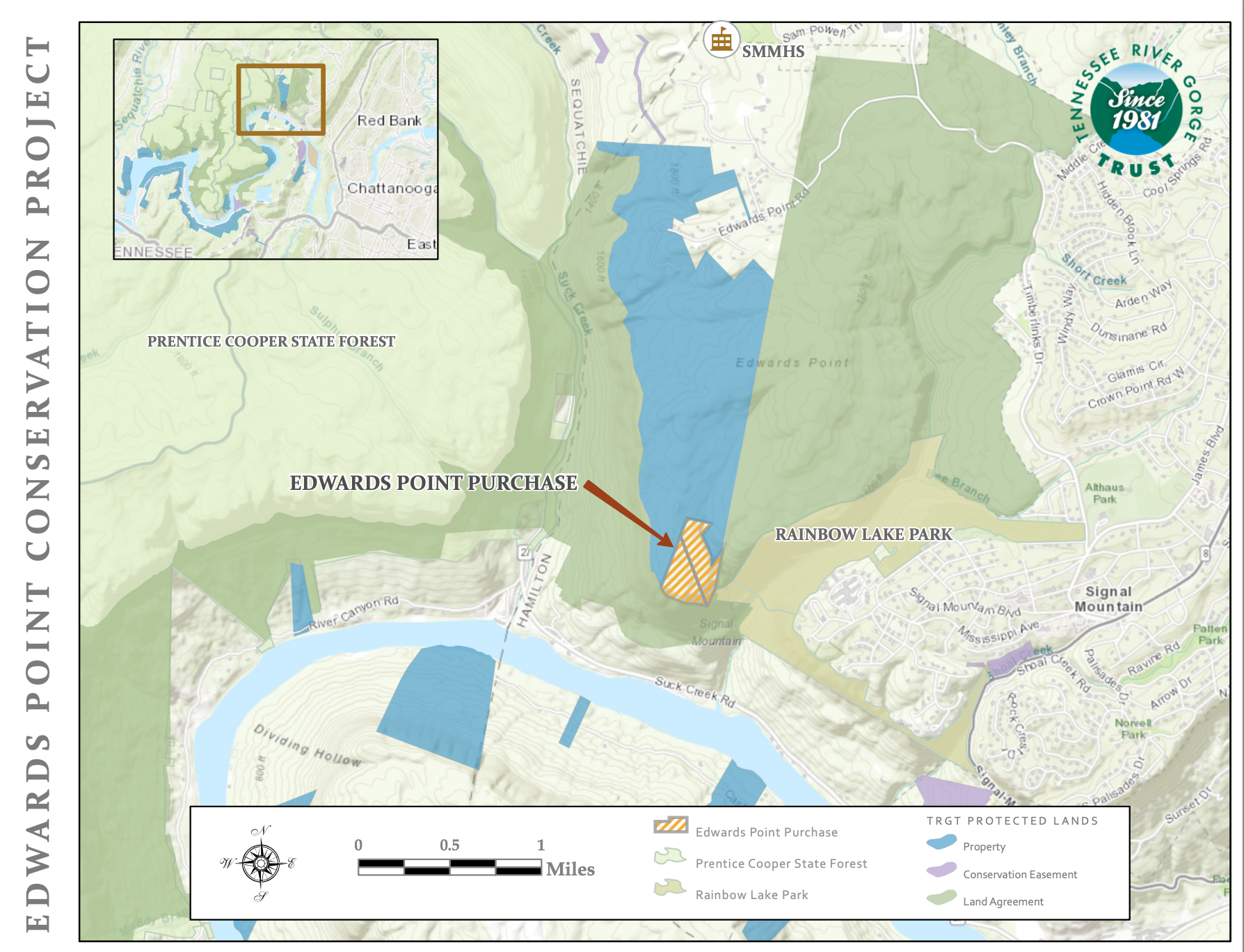
Click Image for full map
In 2022, TRGT purchased Edwards Point atop Signal Mountain in Chattanooga. Edwards Point was a gap in an extensive conservation landscape of protected properties. With this land acquisition, TRGT along with the Prentice Cooper State Forest and the Town of Signal Mountain now protect an area that spans miles from Middle Creek and Signal Point to Suck Creek. The Cumberland Trail, which travels right past Edwards Point, now has secure and permanent public access to the area. An array of ephemeral pools used by amphibian and reptile species can now be managed through informed science-based stewardship. The list goes on, but above all else, we are grateful and proud to say that this open space will remain in its wild state for generations to come.
The View

Edwards Point looks over the upper section of the Tennessee River Gorge. To the east of the point is the Middle Creek drainage and confluence with the Tennessee River. Williams Island, the entrance to the Tennessee River Gorge, is the distant east with Chattanooga in the background. To the west is a spectacular view of the river gorge with Elder Mountain on the river’s left bank and Signal Mountain along the right bank.
The overlook offers incredible sunrises, great views of the astounding Tennessee River Gorge cloud inversion, and a unique viewshed containing metropolitan Chattanooga and the wild River Gorge.
