
Gorge History
The Gorge was formed over 200 million years ago. What's happened in all that time?

Gorge Formation
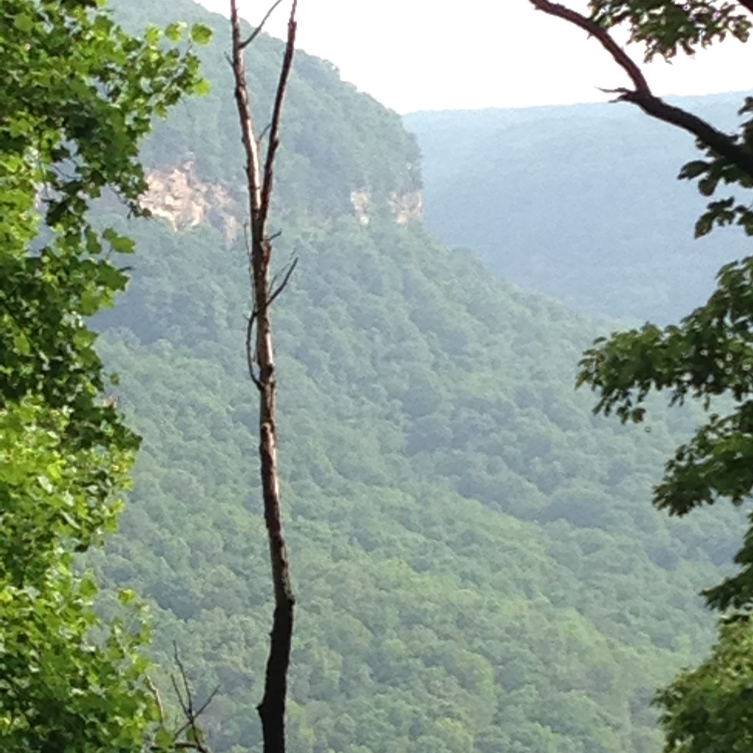
The location of the Tennessee River Gorge near Chattanooga, TN has puzzled geologists for decades. Why should a stream, happily on its way to the Gulf of Mexico, suddenly turn and carve a path through hard sandstone and limestone ledges to reach another valley over ten miles away? And why take such a twisted course? As the crow flies, the Gorge is only eight miles long, but the river twists and turns for twenty-six miles through a massive gap in Walden Ridge.
Most geologists believe the story unfolded like this: some 290 million years ago, the Appalachian Mountains were being slowly uplifted as a result of the collision of Africa with North America. The rock strata around Chattanooga were pushed into a series of mountains and valleys, like wrinkles that run northeast-to-southwest much as they do today. Then a vast seaway entered the area, and a multitude of streams, on their way to the sea, wore away these mountain tops. Later, meandering streams and rivers continued scouring the landscape until the whole nature of these folds reversed. The mountains became the low ground as the limestone rock in them gave way to erosion. The valleys, containing more sandstone, better withstood the erosive force of water and were left as mountains. In other words, what we call Walden Ridge was once a valley and the Sequatchie Valley was a mountain.
At some point, a series of small streams entered cracks in the ramparts of Walden Ridge, slowly eroding a path through the mountain. Emerging on the eastern side, they encountered the Tennessee River flowing southward. Eventually, the waters of the Tennessee were captured and diverted westward through the mountain pass, and the initial stages of the Gorge began.
Today as one views the Gorge, the first impression is of the nearly horizontal line of massive cliffs which ring the entire Gorge. Layers – hundreds of feet thick – of sandstone and conglomerate form these high palisades. Below, the Gorge walls slope gradually down towards the water’s edge with hardly a trace of the underlying rock strata. These lower layers of rock consist primarily of shales, limestones and dolomites which cannot resist the forces of weathering and erosion as well as the sandstone cliffs above. Therefore, the slopes are mantled in a thick covering of weathered material, with the underlying rock strata exposed when a stream, such as Suck Creek, cuts down through the face of the river canyon.
Streams flowing down the sides of the Gorge sometimes encounter a small opening in the rock. There, water can work its way down many hundreds of feet through tiny fissures slowly creating a path called a swallet. Eventually the underground stream encounters resistance and turns horizontal, eroding its way back to the surface much lower down the canyon wall. The Gorge is laced with numerous caves formed in this way. Caverns are simply larger caves that can run for many miles occasionally featuring huge rooms created when underground streams dissolved the surrounding rock.

Today's Gorge
Mature Mixed Mesophytic (Moist) Forest, is now found only in limited areas within the Gorge due to human disturbance. Canopy Trees: a diverse mix such as buckeye; basswood; tulip poplar; sweet gum; sugar maple; red, white and chinquapin oaks; mockernut, bitternut, shagbark hickory; and American beech Understory Trees: silverbell; yellowwood; flowering dogwood; ironwood; and hophornbeam Shrub Layer: sweet shrub; mock orange; spicebush; hydrangea; and Carolina buckthorn Herb Layer: dense and rich especially in spring with flowering species such as bloodroot; Solomon’s seal; St. John’s wort; leafcup; and violets
Dominant Xeric (Dry) Forest, Once atop the Gorge, we encounter the forest type found across much of the Cumberland Plateau. Canopy Trees: a relatively young, open canopy of mixed oaks and hickories allowing for shade-intolerant Virginia and shortleaf pines Shrub Layer: other layers are sparse but may contain patches of farkleberry; blueberries; mountain laurel; Catawba rhododendron; azaleas; redbud; and dogwood Herb Layer: beggar’s lice; pipsissewa; and pussy toes Xeric (Dry) Forest On Slopes, has acclimated to sunnier conditions that become more extreme at higher levels. Canopy Trees: chestnut; chinquapin oak; red and southern red oak; pignut; mockernut hickory; and Virginia pine on the bluffs Understory Trees: sassafras and flowering dogwood Shrub Layer: sweet shrub; blueberries; azaleas; and strawberry bush Herb Layer: somewhat sparse but beggar’s lice; asters; goldenrods; greenbriar; wild grape; and poison ivyEarly settlers came up with these very colorful names for some extremely dangerous places in the Gorge. Immense boulders littered the river bed, restricting even further an already tight squeeze as the Tennessee snaked its way through the Gorge. Some rapids, like the Suck, were most treacherous during the dry season when the river was low, exposing more of the rocky bottom. Others, like the Pot, were dangerous at high water when the river backed up behind rocky banks only 175 feet apart, then cascaded down with a fury like boiling water (suggesting its name). Current through these shoals could be as much as 13 mph – much too swift for ships to overcome unaided! When a hydroelectric dam was built downstream in 1913, the rapids were flooded and calmed, but even today the river current is still formidable as it continues carving out the Gorge.